
Garden City Neighbor Block Sources
The closest reliable starting point for Garden City neighbors is the Wayne County parcel layer. It can show a polygon, property address, ZIP, parcel identifiers, and an owner attribute. Garden City BS&A adds assessment and related municipal records. The deed index tracks recorded land interests one parcel at a time. Other layers, such as QVF data or board agendas, have narrower purposes and should not be made into a block roster.
| Source | What It Shows About a Block | Access |
|---|---|---|
| Wayne Parcel Viewer | Adjacent polygon, address, owner attribute, parcel IDs, ZIP | Public map and REST service; map controls need browser confirmation |
| Garden City BS&A | Assessment owner, situs, related tax and building links | Public municipal hub; detailed screens may require a rendered browser |
| Wayne County Land Records | Recorded title instruments parcel by parcel | Free name index; paid address/parcel/images; counter or mail alternatives |
| QVF request | Lawfully releasable registration data in authorized geography | Written state request with exemptions and limited geographic scope |
| City boards and civic groups | Public officeholder, agenda, and community-contact material | Posted city material or organization/archive permission |
Owners, occupants, and community participants are different categories. A deed can record a trust, estate, lender, or other interest. A GIS owner field can lag the newest recording. A civic agenda may list a public participant without connecting that person to a nearby parcel. Keep source types separate before comparing dates.
Mapping Garden City Neighbor Parcels
The adjacent-parcel method begins at the target polygon. Use the parcel map to locate the full address, then confirm the selected feature’s street field and parcel ID before expanding outward. Record why a second parcel is included: contiguous north, contiguous east, across an alley, same frontage, or corner parcel. Geometry makes that relationship visible without assuming that every nearby door belongs in the same block set.
- Find the target address in the Wayne County Parcel Viewer and record the selected polygon’s address and parcel identifier.
- Click parcels sharing a boundary or separated by a named alley, recording the direction and relationship for each one.
- Compare each parcel’s owner attribute with Garden City BS&A, keeping situs and mailing values as separate fields.
- Use the Register of Deeds only when a dated title question remains. For a full named-street chain, use the Garden City street directory.
A parcel polygon is a land boundary, not a household boundary. A point-to-distance search can find nearby parcels, but distance is not the same as legal adjacency. The record of direction and boundary relationship keeps the method reproducible when a corner lot, alley, or unusual lot shape makes a simple visual guess misleading.
Garden City Query Distance Method
The official Wayne County FeatureServer supports polygon geometry, query-with-distance, pagination, order-by, statistics, and advanced query formats. It documents `ownername1`, `propstreet`, `propcity`, `propzip`, `PID_All`, `packedParc`, `fullAddres`, parsed street fields, and the parcel polygon. The service accepts up to 2,000 records per request, so a broad query may need pagination. Its text interface does not document a ready-made consumer button labeled for neighbors.
| Map attribute | Use in an adjacent-parcel check |
|---|---|
| `fullAddres` / `propstreet` | Confirms which property feature was selected. |
| `ownername1` | Provides a GIS owner attribute to verify in assessment or deed records. |
| `PID_All` / `packedParc` | Supplies a reproducible key for another official search. |
| Polygon geometry | Shows the parcel shape and shared-boundary relationship. |
| Query with distance | Finds nearby features where the configuration permits, without proving adjacency. |
The Wayne County parcel layer is shown below with the attributes that support a Garden City neighbors search.
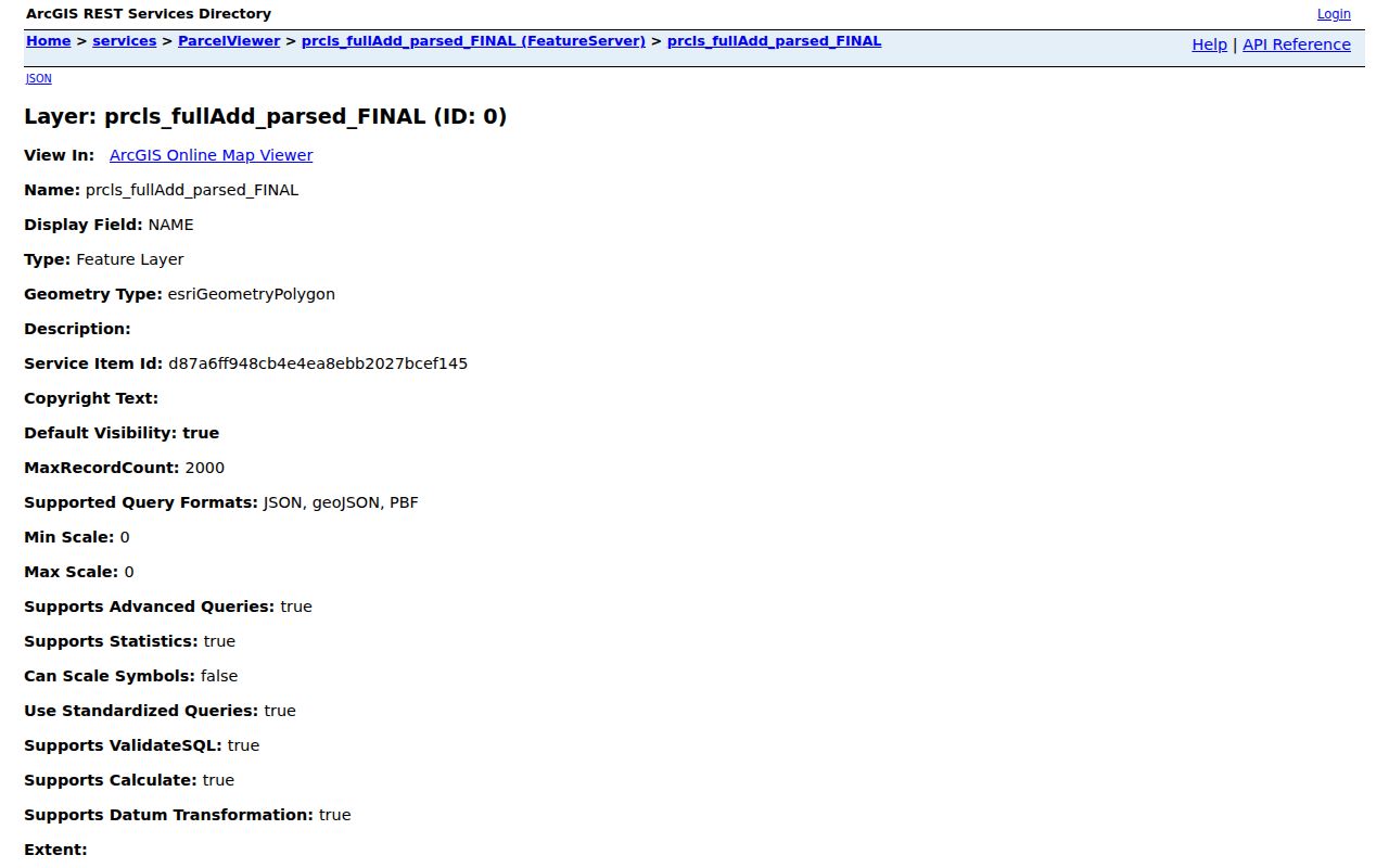
The screen documents parcel attributes and query capability. Confirm a current title question with Garden City BS&A and the Register of Deeds rather than treating a GIS owner value as a final answer.
Garden City Civic Neighbor Layer
Community records can add a public civic layer to Garden City neighbors research, but they are not a resident directory. Official city links identify the Garden City Community Coalition, Garden City Business Alliance, Garden City Garden Club, Kiwanis of Garden City, Rotary Club of Garden City, local youth sports organizations, and the Historical Commission. The boards page separately lists municipal bodies and public meetings.
| Public community source | What the record can support | Access limit |
|---|---|---|
| Planning Commission and Zoning Board | Public agendas, hearings, and named civic participation | Not a parcel-owner or member list |
| Parks and Recreation, DDA, Library Board, Board of Ethics | Public board roster and meeting material where posted | Use agendas and minutes in their stated context |
| Historical Commission | Historical-city activity and public meeting material | Not proof of residence at a particular address |
| Garden Club, Kiwanis, Rotary, Community Coalition | Organization and community-contact leads | No public membership roster was located |
| Church or archive records | Historical records only when the keeper offers access | Ask permission; do not assume member disclosure |
The official Garden City boards and commissions page provides the municipal community-network layer shown below.
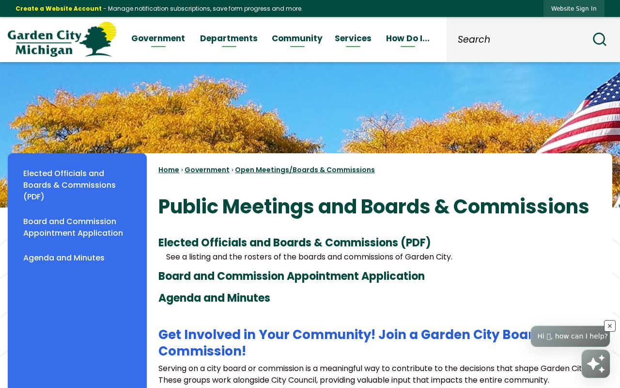
Public board material can explain a civic role, meeting, or address hearing. It should not be turned into a list of neighbors, club members, or households.
Garden City Voter Layer Limits
Michigan’s Qualified Voter File is maintained by election authorities, and voter-registration records are public through FOIA with specific exemptions. A QVF request can be scoped to an entire city or township, district, ward, precinct, school, or village. The request form does not advertise an arbitrary street-radius request. For a Garden City block, precinct or ward context is the appropriate public-record geography, not a claim that the file creates a complete neighbor list.
Lawfully releasable data can include a complete name, residential or mailing address, year of birth, registration date, status, voter ID, and participation history when requested and available. Full date of birth, driver-license or state-ID numbers, phone, email, digitized signature, and Social Security digits are withheld. A registration status can change with address updates, returned mail, cancellation, or other file maintenance. It is not a statement of who is physically present today.
Garden City Neighbor Source Comparison
Official records and commercial neighbor-search products use different source chains and should be read differently. A county parcel layer supplies a visible field structure and a custodian. The assessor can clarify a municipal property record. A deed index provides a recorded instrument trail. A commercial product may collect or republish information from varying dates and sources, so a display should be tested against the official record before it is relied on.
| Source category | Best use | Key limit |
|---|---|---|
| Official parcel, assessment, and deed records | Check a specific land or recorded-interest question | Owner and occupant are not interchangeable; update dates differ |
| Official election and civic records | Check authorized registration geography or public civic activity | Withheld fields, scope rules, and context remain important |
| Commercial neighbor tools | Possible lead to verify against a custodian | Coverage, date, source, and accuracy may be unclear |
Note: A clean parcel match is more useful than a long compiled list, because the source and date can be checked again.
Garden City Protected Address Limits
Several categories should end a neighbor search. Title records do not list every household member. Voter data does not list every person present and may include inactive or cancelled file states. Utility customers, mail-delivery data, and motor-vehicle addresses are not public block lists. Michigan’s Address Confidentiality Program gives qualifying participants a designated address and protects the actual location from ordinary FOIA disclosure.
Do not try to infer an ACP participant’s physical location from a voter entry, mailing field, or an apparent record mismatch. Sealed, juvenile, victim, adoption, and other protected information also remains protected. A correction or privacy concern belongs with the source custodian or the Address Confidentiality Program, not with a broadening block search.
Garden City Neighbor Stop Rule
Stop when the next source has no clear, lawful question to answer. A targeted parcel check can end after a parcel ID, dated owner attribute, and recorded instrument agree. A public civic entry can end after the meeting record is read in context. Broadening the search to link household members, protected addresses, or unrelated personal details produces less reliable work and crosses the purpose of these sources.
Garden City’s older lot patterns also reward caution. The county profile describes large legacy lots and an uncut-street example between portions of Bock Street and John Hauk Street where Donnelly Avenue does not cut through. A map can make parcels look near when the legal relationship is different. Use the parcel polygon, lot or legal description, and recorded source before treating a visual street pattern as a neighbor connection.
For a historical block question, use community sources only as dated leads. Garden City Presbyterian Church records for 1840 to 1966 and St. David’s Episcopal Church records for 1955 to 2008 are catalogued leads, while the Wayne Historical Society reports local newspapers, maps, obituaries, documents, and digital Sanborn material. Access depends on the keeper. Record the volume, page, or archive description, and do not treat an old membership or directory entry as a current neighbor record.