
Garden City ZIP Code Areas
Garden City has two documented postal functions. The standard street-delivery ZIP is 48135. Postal material identifies 48136 as a Garden City PO-box designation. These are not two interchangeable residential areas. For a deliverable address, use the USPS ZIP Code Lookup first, then confirm the land record with the city or county source that owns it.
| ZIP | Areas Covered | Post Office | Notes |
|---|---|---|---|
| 48135 | Standard street-delivery Garden City | Garden City Post Office | Main residential delivery ZIP. Postal lines do not establish municipal boundaries. |
| 48136 | Garden City PO-box designation | Garden City postal facility / centralized PO-box service | Postal-box function. No ordinary street-delivery residential geography is claimed. |
Garden City’s incorporated population is counted as a city figure, not as proof of a PO-box ZIP population. A Garden City 48136 mailing address can show where mail is received while revealing nothing about the holder’s physical parcel. The difference matters when sorting an old notice, an organization address, or a record that contains a mailing field.
Garden City ZIP Search Steps
A ZIP search should move from the precise postal answer to the parcel record. The order is deliberate. USPS resolves a delivery question. The county GIS layer exposes a parcel’s `propzip` attribute. Garden City BS&A and the deed system provide address, owner, parcel, or legal-description context. A result in one system is a reason to check the next system, not proof that all fields describe the same date.
- Enter the complete address in USPS By Address and retain the returned postal ZIP.
- Search or pan to the address in the Wayne County parcel layer, then note the parcel ID, full address, and `propzip` field.
- Confirm the situs and any distinct mailing address in the Garden City BS&A hub.
- Use the legal description or parcel ID if a title question needs the Register of Deeds, rather than treating the ZIP as a title key.
When a ZIP result narrows the search to a named street, the Garden City street directory has the fuller address-by-address workflow. A ZIP is the starting slice, not a substitute for a parcel trail.
Garden City ZIP Parcel Fields
The Wayne County Parcel Viewer has a more useful ZIP layer than a generic city search because it attaches postal and land attributes to individual polygons. Its REST feature service documents `ownername1`, `propstreet`, `propcity`, `propstate`, `propzip`, `PID_All`, `packedParc`, `fullAddres`, parsed street number and street name, plus polygon geometry. A request can query ZIP values, but complete result sets require pagination when the transfer limit is reached.
| Parcel field or control | ZIP research use |
|---|---|
| `propzip` | Postal ZIP carried by the parcel layer. |
| `fullAddres` / `fullAdd2` | Full-address text to compare with USPS output. |
| `PID_All` / `packedParc` | Durable parcel identifiers for assessor, tax, and deed research. |
| `ownername1` | GIS owner attribute, which must be confirmed for a current title question. |
| Query and pagination | Supports advanced searching, but a ZIP-wide query can exceed the service’s transfer limit. |
The official Wayne County parcel query endpoint is shown below in a ZIP-level search context.
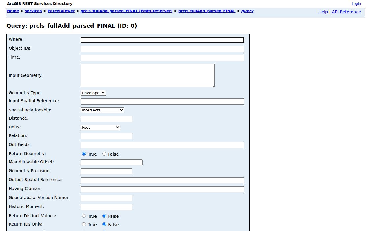
Parcel geometry identifies the land boundary, not a household. The owner attribute also has its own update cycle, so a current property question belongs back in BS&A and, where needed, the Register of Deeds.
Garden City ZIP Tax Context
The Wayne County Treasurer’s property-tax listing can assist after an address is known, but it is not a ZIP-directory search screen. The public controls use municipality, street number, street name, address, and parcel modes. The research found no dedicated ZIP field there. A partial street search can accept a street-name prefix and optional number, yet the returned scope is delinquent-property information rather than a complete assessment roll.
The Wayne County tax portal below shows the address, municipality, and parcel style of this supporting search.
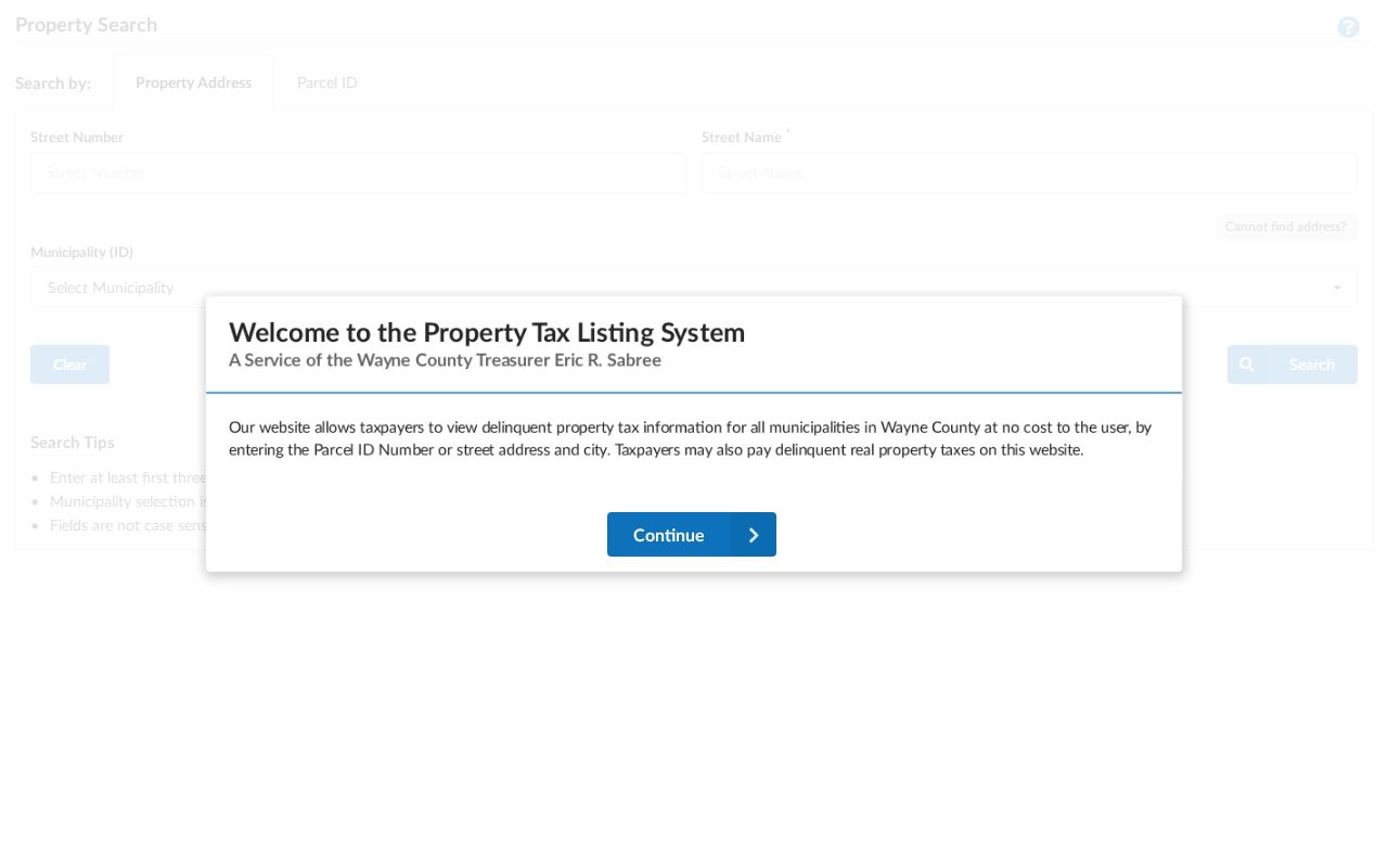
Use a tax result to identify a delinquent-tax record for the matched parcel. Do not let a ZIP, a blank field, or a tax status become a statement about every address in Garden City.
Garden City ZIP Code Tools
USPS offers three distinct ways to test postal geography: By Address, By City and State, and Cities by ZIP Code. By Address is the best choice for a particular deliverable location. By City and State returns ZIP codes associated with the named postal city. Cities by ZIP Code returns postal city and state associations. Each answers a postal question, and the official lookup warns that its result does not confirm that a person or company is at an address.
The parcel layer and postal lookup are complementary. USPS tells you the delivery ZIP for the entered address. The county layer links a property feature to current GIS attributes. The city assessor and Register of Deeds resolve physical situs, parcel, and recorded-land questions. If the results disagree, preserve the exact address form and ask Garden City Building, Planning, or the county GIS office which source governs the disputed field.
Census ZIP Code Tabulation Areas serve a different purpose. They are statistical approximations and should not be used to settle a delivery or boundary question. The research found no official ZIP-by-ZIP population table for Garden City and no ZIP split or realignment year. That gap matters: a demographic table, a postal label, and a tax parcel each describe a different unit. For a current address, the exact address lookup remains the sounder check.
Garden City ZIP Boundary Checks
A ZIP boundary is a delivery geography, while a city limit is a legal municipal boundary. Situs address is the physical location used in assessment, GIS, and permit records. Mailing address is where a responsible party receives correspondence. Legal description is the subdivision lot, block, or metes-and-bounds identity in recorded land material. Those fields can differ without an error.
Nearby postal areas can be associated with Inkster, Westland, Livonia, Dearborn Heights, or Wayne, but the documented standard street-delivery ZIP for Garden City is 48135. No official parcel-level inventory of postal-city and city-limit mismatches was found. Verify a particular edge address with USPS, the GIS parcel record, and Garden City BS&A rather than generalizing from a nearby ZIP.
Garden City’s own address authority is distributed. The assessor, Building, and Planning functions maintain city-side context, while Wayne County GIS and the Register of Deeds hold county parcel and land layers. For a disputed situs or emergency address, ask Garden City Building or Planning, or the county GIS office, which record is authoritative for that particular field. The answer can vary by question: a postal ZIP resolves delivery, a GIS polygon resolves a mapped parcel, and a recorded legal description resolves land identity.
- ZIP versus ZIP+4
- A ZIP identifies a delivery area. ZIP+4 adds a smaller delivery segment and is not a property identifier.
- PO-box ZIP
- A ZIP used for postal boxes. It can identify mail service without locating a physical parcel.
- Unique ZIP
- A ZIP assigned for a single organization or special delivery purpose, when USPS designates one.
- Carrier route
- A mail-delivery sequence used by the Postal Service. It is not a city-boundary or residency record.
Garden City ZIP Identity Myth
A ZIP code does not identify a resident. It does not prove ownership, title, voter status, occupancy, household membership, or a person’s current location. The same limitation applies to a parcel owner name, which may show a title interest or an older GIS attribute rather than every person at that address. A postal result is still useful, but only for the delivery question it answers.
Michigan’s voter-file request structure follows jurisdiction, district, ward, precinct, school, or village scopes rather than a ZIP option. The Michigan public-safety registry can accept ZIP as a geography field for its specialized purpose, but it is not a general resident directory. Keep each search within the source’s stated scope.
Garden City ZIP Record Keys
Parcel IDs are the durable bridge when an address has several geographic labels. Wayne County exposes `PID_All`, `PID_Dborn`, and `packedParc`; its tax portal describes non-Detroit parcel identifiers as 14 to 16 characters without spaces or dashes. Copy the identifier exactly from the first official result. Then use that same key through GIS, tax, assessor, and deed research.
Garden City began as a village in 1927 and became a city in 1933, so older records can use a predecessor or broader jurisdiction label. No official street-renumbering or ZIP-realignment schedule was found. A legal description, plat, or parcel ID is the safer bridge for an old address than guessing from a postal label. That restraint keeps the ZIP code directory useful for both present-day checking and historical research.
Municipal address records add another layer, but each must be searched as its own source. The BS&A hub advertises assessing, building, planning and zoning, special-assessment, utility-billing, and related services. The unattended research did not confirm every Garden City detailed search field or its historical coverage. A building or permit entry can date work at a parcel, yet it is not a deed and an applicant is not automatically an owner or occupant. When a ZIP code points to an address, identify the record type before drawing a conclusion from it.