
Tracing Garden City Streets
Street research in Garden City begins with a physical address, not an assumed household. Garden City BS&A supplies the municipal owner, address, and parcel route. Wayne County GIS adds a mapped parcel and parsed address attributes. The Register of Deeds supplies title instruments and legal-description clues. Michigan voter data has a separate, constrained public-access path, while Polk and Bresser books offer dated historical address evidence. A name that appears in one layer should be checked against the parcel and date before it is carried to the next layer.
- Enter the current number and street in Garden City BS&A and capture the situs address, owner of record, parcel ID, and separate mailing address if displayed.
- Open the same location in Wayne County Parcel Viewer, select the polygon, and compare its parsed address, ZIP, owner attribute, and parcel identifiers.
- Search the confirmed owner in the Register of Deeds free grantor or grantee index, recording the document number and recording date.
- Use On-Demand, a counter search, or mail service when the legal description, parcel search, image, older record, or certified copy is necessary.
- For an old address, read the appropriate Polk or Bresser street section and compare the year, number, abbreviations, and nearby entries.
Note: This address-to-owner-to-deed-to-voter-to-criss-cross order keeps title, registration, and historical directory evidence in separate lanes.
Garden City Street Search Fields
The Garden City BS&A hub confirms the main public entry points: Address, Name, and Parcel Number. It also links Assessing Search, Current Tax Search, Building Department Record Search, Detailed Record Search, Special Assessment Search, and Utility Billing Record Search. Detailed screens are JavaScript-dependent and their exact rendered controls were not safely captured. The table therefore preserves confirmed hub fields without inventing a wildcard rule or a full parcel-card layout.
| BS&A field or mode | Type | Required | Garden City use |
|---|---|---|---|
| Address | Text or autocomplete | Portal-dependent | Confirmed hub route for a known street address. |
| Name | Text or autocomplete | Portal-dependent | Confirmed owner-name route; test name variants. |
| Parcel Number | Text or autocomplete | Portal-dependent | Use the identifier copied from an official result. |
| Assessing Search | Button or tab | No | Assessment-specific route listed on the hub. |
| Current Tax Search | Button or tab | No | Current municipal-tax route listed on the hub. |
| Building Department Record Search | Button or tab | No | Building-record route, with rendered fields not yet verified. |
The Garden City assessing search is the source for this address-first interface.
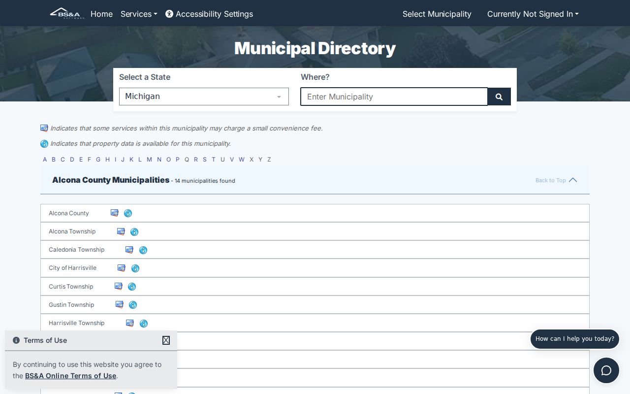
The municipal interface provides the starting choices, while the returned official parcel ID becomes the durable cross-record key.
Garden City Street Address Roles
A situs address is the physical location used by the assessor, GIS, permits, and many tax records. A mailing address is where an owner or responsible party receives correspondence. A legal description is the recorded land identity, such as a subdivision lot and block or metes-and-bounds language. A ZIP code is a postal delivery label. These values can differ without showing an error, so copying the exact field label is a core Garden City street directory habit.
- Parcel
- A defined land unit with an identifier used across assessment, GIS, tax, and deed research.
- Situs address
- The parcel's physical location, distinct from an owner mailing destination.
- Plat
- A recorded subdivision map that helps connect lots, blocks, and legal descriptions.
- Criss-cross directory
- A reverse directory organized by street and house number for a dated address check.
When an older street label does not match a current number, use the legal description, parcel ID, plat, historic map, and deed parties before suggesting a connection. Research did not locate an official citywide renumbering or renaming schedule for Garden City.
Garden City GIS Street Parcels
The Wayne County Parcel Viewer layer is a public polygon service. Its documented fields include ownername1, propstreet, propcity, propstate, propzip, packedParc, PID_All, fullAddres, numStreet, nameStreet, and polygon geometry. The service supports queries, ordering, pagination, statistics, and query with distance. A map user can pan to a street, select a parcel polygon, and read the available attributes. A polygon traces land, not every person connected with an address.
The layer has a maximum record count of 2,000. Its owner attribute has its own update cycle and may lag a newly recorded document, so confirm a current title or assessment question in BS&A and the Register of Deeds. The official interactive-maps page advertises Parcel Viewer, but the unattended inspection did not confirm a full overlay menu or a specific map-button sequence.
The Wayne County Parcel Viewer service is shown below.
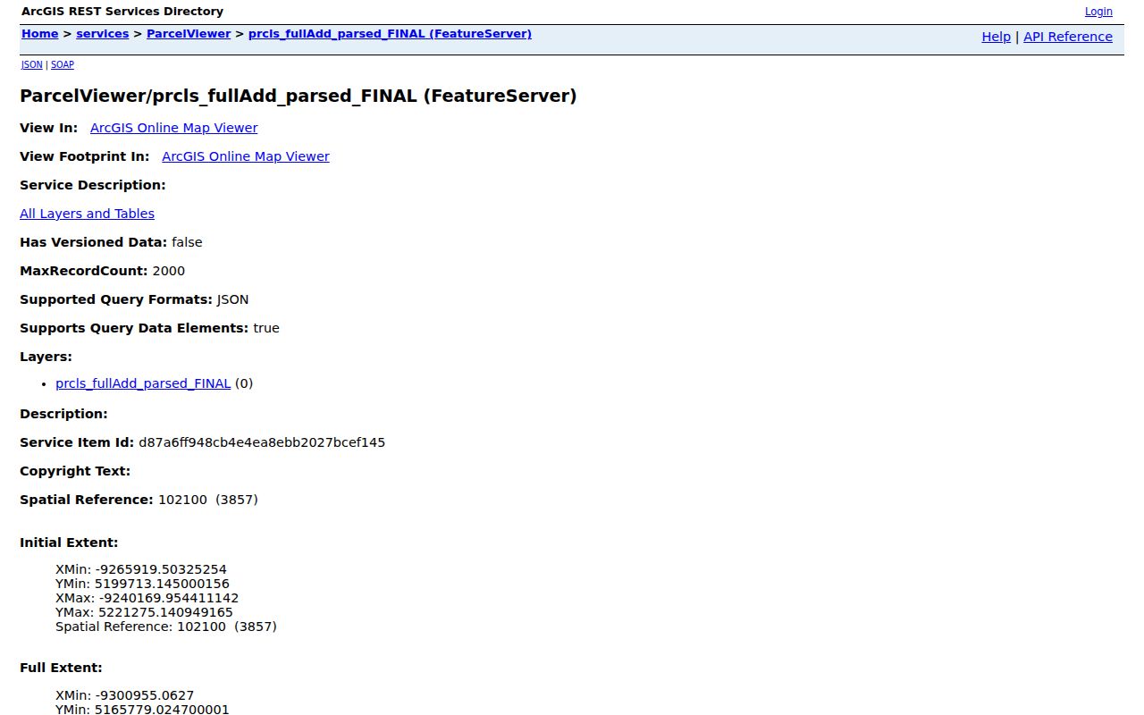
Use the selected polygon's address and parcel identifiers to test an assessor result, not as proof of a complete household.
Note: Adjacent polygons can be useful for mapping a block, but geometry is not a claim about occupancy.
Garden City Street Tax Results
Wayne County Treasurer's Property Tax Listing is the clearest documented partial-street control. It searches delinquent real-property information by street number, street name, municipality, or parcel ID. The street-name field needs at least the first three letters. Street number is optional and can be a prefix. Municipality is optional, and a blank municipality searches all municipalities. A full non-Detroit parcel ID uses 14 to 16 characters without spaces or dashes.
This is a delinquent-tax listing, not a replacement for Garden City's current assessment card and not a complete roll of parcels on a street. Use it to narrow a known tax or parcel question. If the result is useful, compare its parcel and address against BS&A and GIS before looking for a recorded instrument.
Garden City Street Record Coverage
Address-keyed records offer different kinds of evidence along a Garden City street. The most dependable chain carries the parcel ID and legal description forward. A tax status does not prove title. A title instrument does not identify every person connected with an address. A permit or code file can date activity, but its applicant may have a role different from owner of record. This table shows the available channels and their limits.
| Address record | Keeper | What it can show | Access path |
|---|---|---|---|
| Current assessment card | Garden City Assessor / BS&A | Owner, situs, possible mailing, values, physical characteristics where exposed | Free hub; counter or FOIA if needed |
| Delinquent tax listing | Wayne County Treasurer | Parcel, address, municipality, delinquency or payment status | Free address or parcel search |
| GIS parcel polygon | Wayne County GIS | Boundary, owner attribute, parsed address, ZIP and parcel IDs | Public map and REST service |
| Deed and mortgage index | Wayne Register of Deeds | Parties, instrument, date, liber/page, document number and legal description | Free name index; paid expanded modes; counter or mail |
| Permit, inspection, code or zoning file | Garden City departments | Address activity, dates, hearings and public fields where available | BS&A route or specific FOIA request |
Garden City BS&A has building, planning, special-assessment, and utility-billing tiles, but no exact public field list or archive start year was confirmed for each endpoint. Preserve that gap in a request rather than assuming a result should be online.
Garden City Street Deed Chains
Wayne Register of Deeds supports a free public name search for grantor and grantee listings. The free index does not provide images. Paid On-Demand access adds address, legal-description, parcel or tax-ID, liber/page, and document-image functions for $6 plus fees per 15 minutes or $24 per 60 minutes. Counter and mail remain the path for older records and certified copies. The current search page describes online searching and printing from January 1, 1960, while the land archive reaches to 1703 and electronic indexing began in 1986.
For each confirmed parcel, open or order the purchase deed, record its grantor, grantee, date, instrument type, and legal description, then search the prior grantor as an earlier grantee. Continue one transfer at a time. Mortgages, liens, releases, easements, probate conveyances, and tax deeds can place names in a chain without establishing a residential connection.
Garden City Street Voter Access
Michigan Qualified Voter File data can contain legally releasable residential and mailing address, year of birth, registration date, status, voter ID, and participation history. Its ordinary MVIC search is designed for a voter's own status and does not provide a street-wide directory. A Garden City street request instead follows the QVF data-request and FOIA process, scoped to a city, township, district, ward, precinct, school, or village. The form does not advertise an arbitrary street-radius request.
Michigan withholds full date of birth, phone, email, ID numbers, digitized signature, Social Security digits, and Address Confidentiality Program physical addresses. A registration source is therefore a limited, dated registered-residence record. It does not show every person present at a parcel, and it does not reveal ballot choices.
Garden City Street Permit Files
Permits and code cases add a date to a Garden City street narrative. Ask Building, Inspection, Code Enforcement, or the FOIA coordinator for a narrow address-and-date-range file. A useful request identifies a permit number when known and asks for issue date, work description, inspection result, public applicant or contractor fields, zoning or variance hearing date, and case disposition. It should also distinguish the target physical parcel from a nearby address.
Garden City's staff directory lists Building at 734-793-1650, Inspection Line at 734-793-1656, and Code Enforcement at 734-793-1807. A permit is not a deed, and an applicant is not automatically an owner of record or an occupant. Pair an address-date file with a parcel, deed, map, or dated directory entry to avoid overreading it.
Garden City Legacy Street Lots
Garden City was shaped by early one-acre garden-city sites, and some larger legacy parcels remain. Wayne County's community profile describes an irregularity between parts of Bock Street and John Hauk Street where Donnelly Avenue was not cut through. That local pattern is a reason to read parcel polygons and legal descriptions rather than infer adjacency from a straight street line. A street map can orient a search, but it does not replace a plat or recorded land description.
The city became a village in June 1927 and a city in 1933. Earlier documents or directories may use a rural or predecessor jurisdiction label. Where a chain breaks, compare the plat, lot and block, parcel identifier, historic map, tax card, and deed parties, then ask City Building, Planning, or the Clerk to confirm a specific address history.
Garden City Street Directory History
Polk Wayne, Garden City, Inkster volumes for 1947, 1951, 1954, 1956, 1958, and 1960 provide a dated address layer. Broader Bresser West Wayne and Dearborn/Downriver runs can add reverse-address clues. Read a volume's front matter, abbreviation key, coverage, and street section before interpreting an entry. Initials, OCR mistakes, and a regional title can hide a useful Garden City reference or create a false one.
Use the street section to confirm a house number and neighboring entries, then compare the surname section. The historical collections themselves are covered in the Garden City City Directories page. For a current parcel question, return to BS&A, GIS, and the deed index rather than treating a mid-century listing as a present-day answer.
Garden City Street Directory Limits
Myth: A parcel, deed, ZIP, or voter record reveals everyone at a Garden City address. Each source answers a narrower question. Title records show recorded interests. GIS polygons show parcel boundaries. A voter file concerns registered voters and may include stale or inactive records. Motor-vehicle data is protected by the Driver's Privacy Protection Act, and utility-customer and delivery information are not public street-directory sources. Address Confidentiality Program participants have protected physical locations.
When an official source has a factual error, retain the parcel or document number and send the correction to its keeper: the Garden City Assessor or Board of Review for assessment issues, Register of Deeds for land indexing, City Clerk or Bureau of Elections for voter issues, and the court of record for court information.
Note: A blank field means the source does not expose that field, not that no fact exists.